Manual for Instruction in Military Maps and Aerial Photographs (Harper's Geoscience Series)
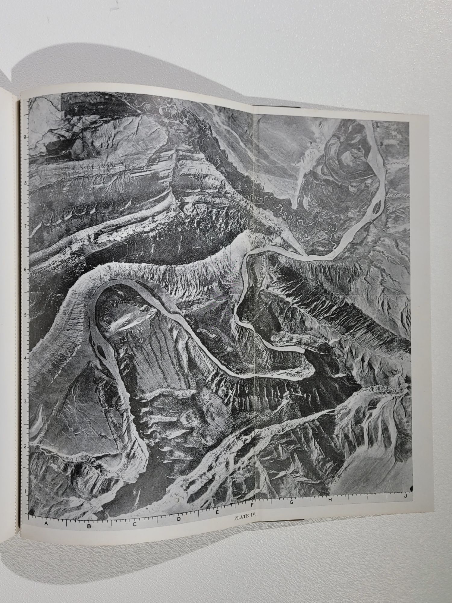
New York: Harper & Brothers Publishers, (1943). First printing. Black and white aerial photos, text figures. Cloth hardcover. Octavo. xxvi, 138 pages + plates.
Little known first book by Norman Maclean, author of "A River Runs Through It". This manual grew out of a course taught by Maclean and Olson for The Institute of Military Studies at the University of Chicago. Provides a thorough and concise outline of instruction intended for World War II soldiers.
Maclean's interest in maps began when he worked for the U. S. Forest Service in his youth, and at Chicago he was a respected teacher in subjects ranging from lyric poetry to rifle marksmanship. Maclean was the Acting Director of The Institute of Military Studies when this manual was published.
Stated "First Edition" with correct Harper code on copyright page. This manual was reprinted later in 1943, and first printings in collectable condition are quite uncommon.
The five folded black and white aerial photographs on perforated stubs are intact and in place at rear.
Bound in grey cloth over boards with red and blue stamped spine and upper board. Neat prior owner name stamp on front free endpaper. Some light soil to external cloth, a hint of fading to spine. Pastedowns have browning near gutters. Overall a bright and clean copy.
Item #865
Sold