
Aeroplane Views of Baltimore Harbor and Approaches
[Baltimore]: (S.n.), [1924?]. First edition. Black and white photographs, map. Embossed paper covers over side-stapled binding. Oblong quarto. 68 leaves, printed on rectos only.
A remarkable and quite scarce visual record of the western Chesapeake and Patapsco River shorelines from just north of Annapolis through the industrial and commercial docks in Baltimore and on out to North point in the early 1920s.
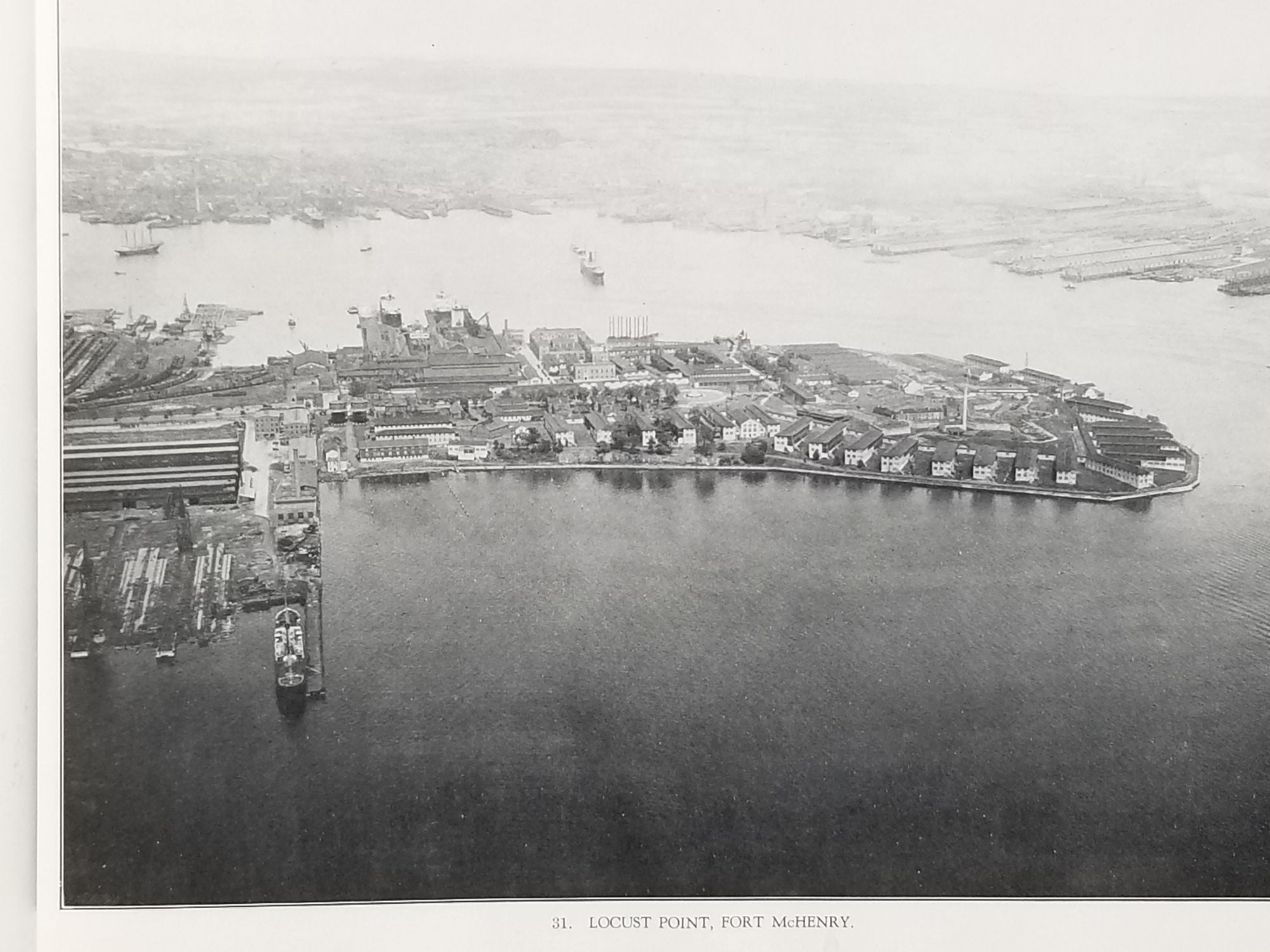
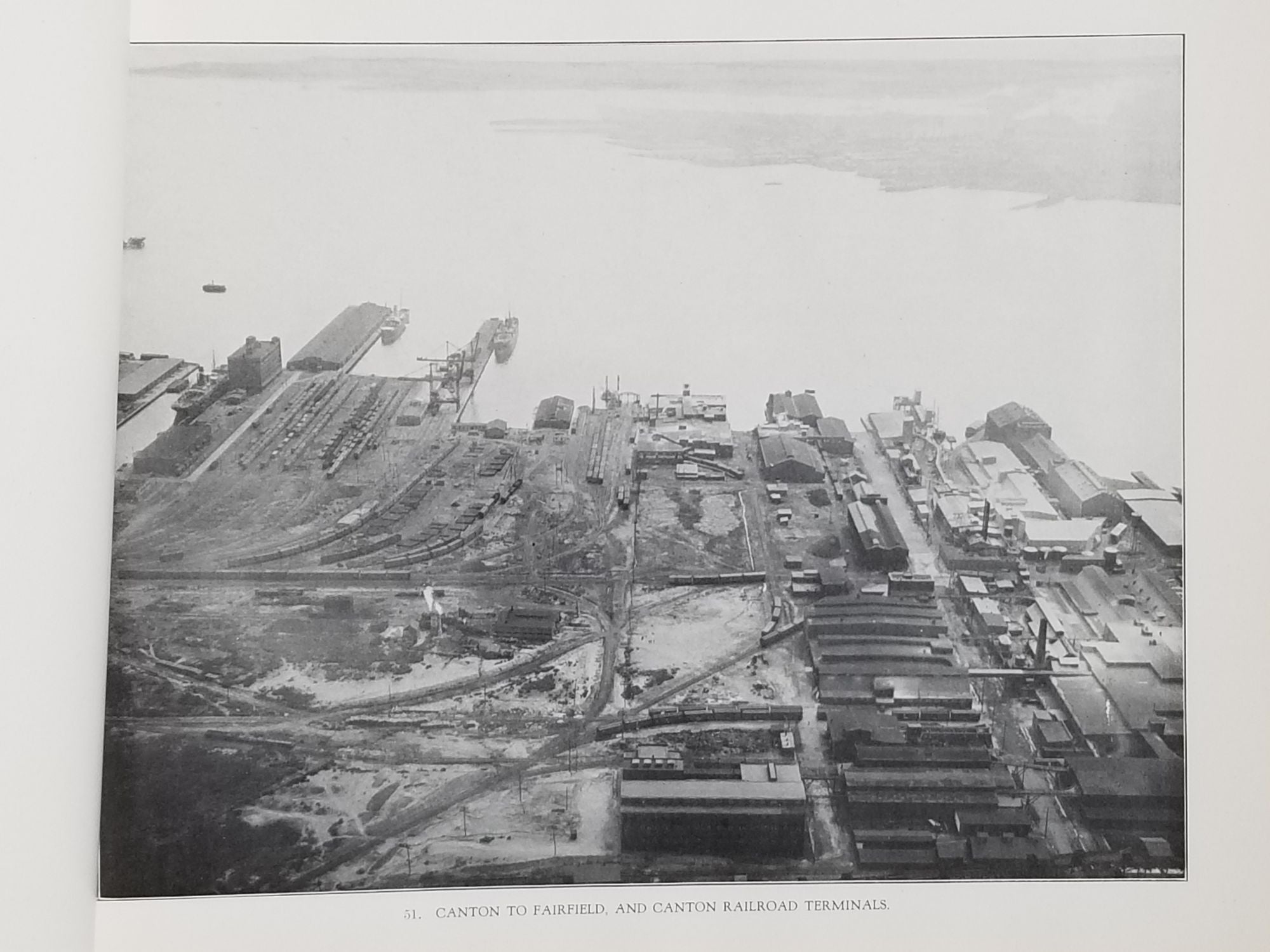
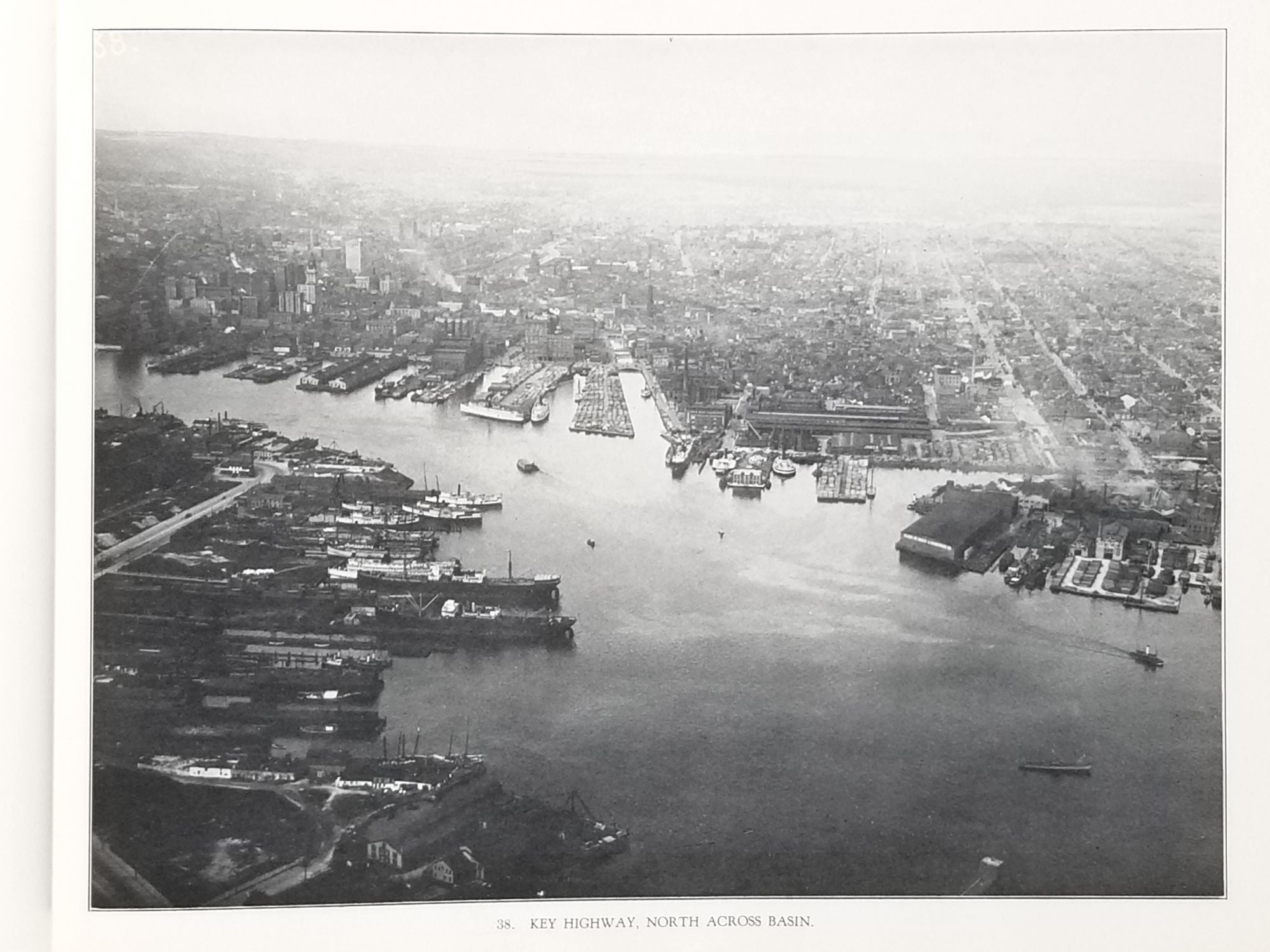
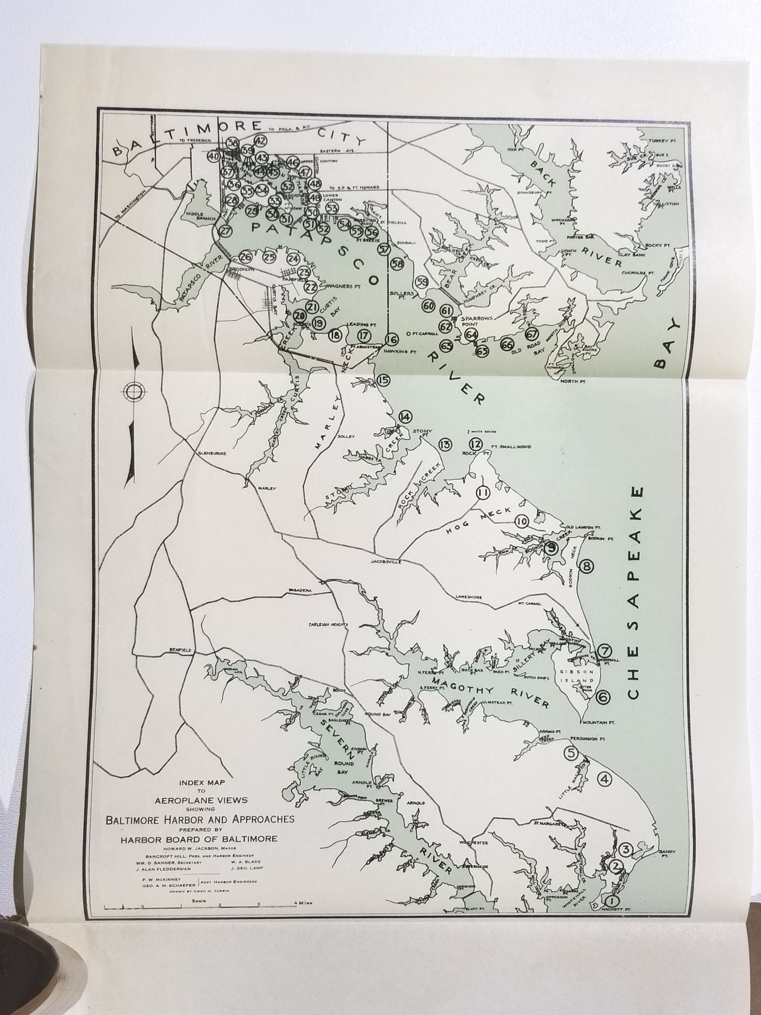
Consists of 67 full page black and white aerial photographs taken by the U. S. Navy, Bureau of Aeronautics under the command of Rear Admiral W. A. Moffett. The series of photographs documents the shoreline from "the west side of the Chesapeake Bay north of the mouth of the Severn River, and continuing up the west side of the bay; Patapsco River, and Baltimore Harbor, passing around the Upper Basin and down the East Side of the Harbor and River to North Point." The photographs of Fort McHenry show the World War I barracks in place. A fold-out index map tipped onto inside rear cover shows the locations of all 67 photographs.
Very good. Covers have a few short edge tears and shallow wrinkles.
Item #639
Sold