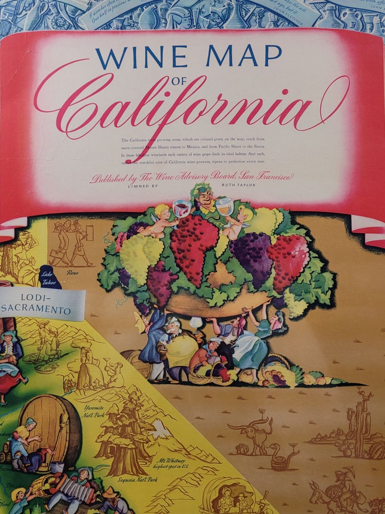
Wine Map of California
San Francisco: The Wine Advisory Board, [1942?]. Pictorial map. Singe sheet 31 1/2" x 41", professionally mounted on linen to 35" x 44 3/4"
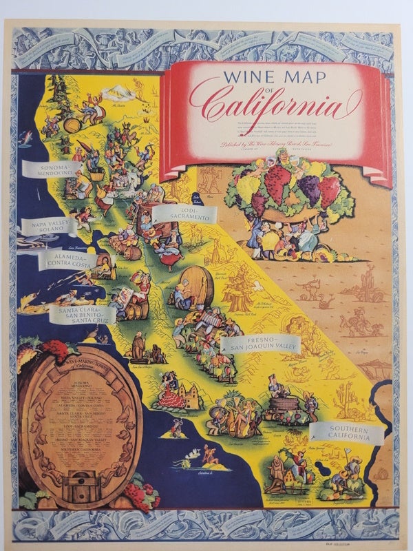
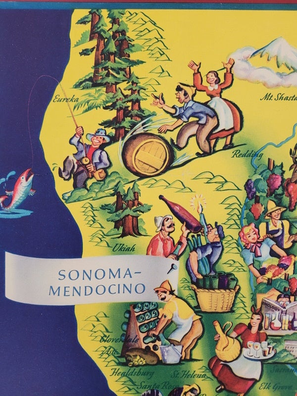
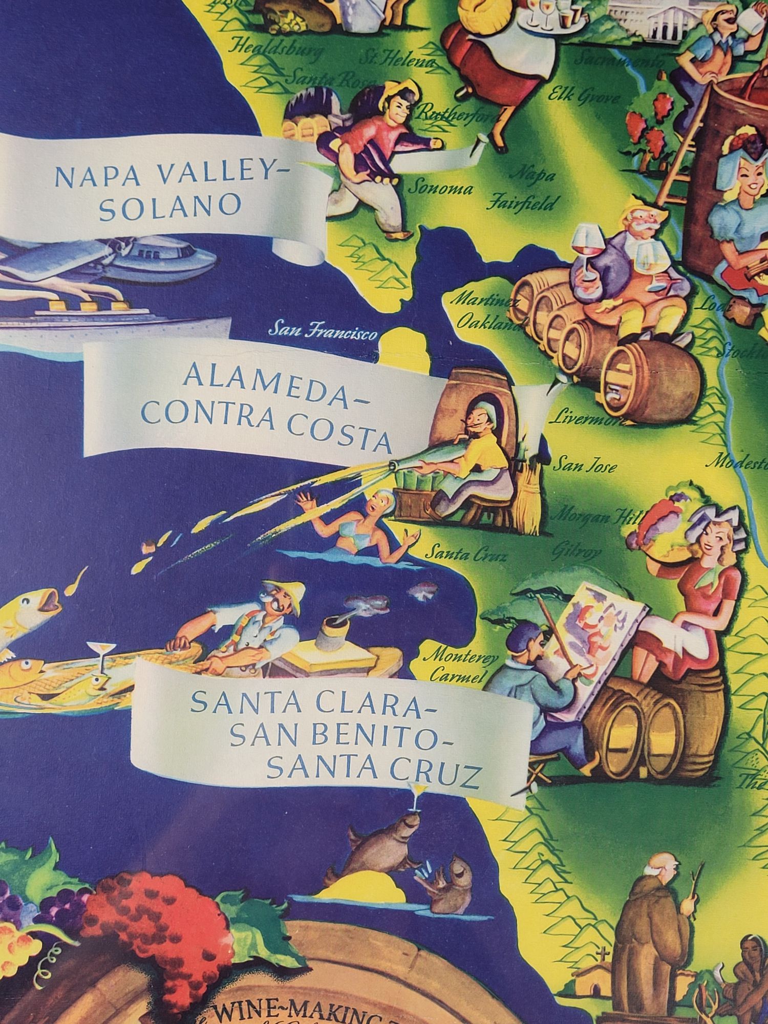
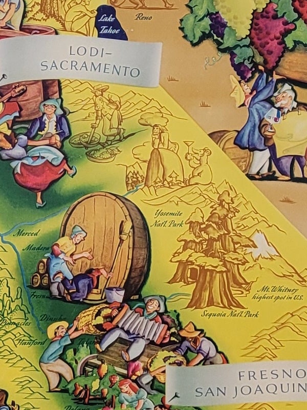
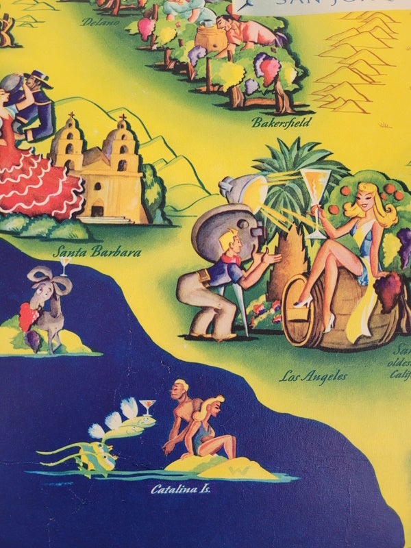
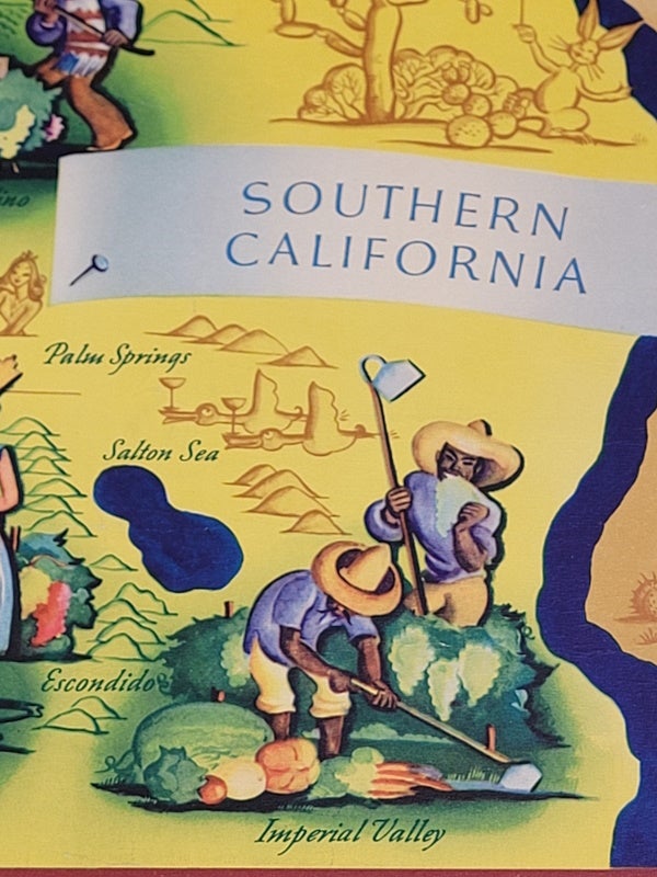
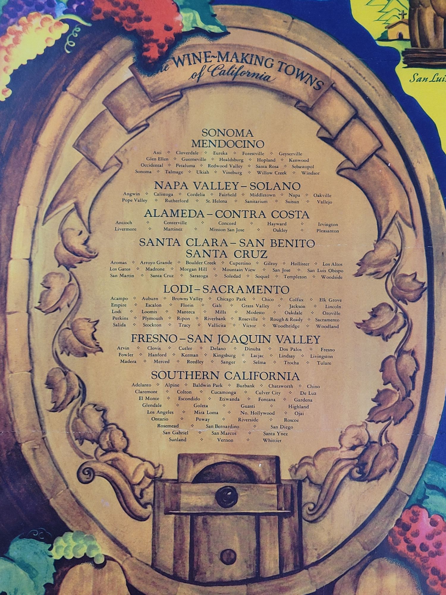
One of the more famous of the colorful pictorial maps by brilliant artist of the genre, Ruth Taylor White. In this gorgeous map, commissioned by California's Wine Advisory Board, she depicts the bountiful vineyards, wine-drinking inhabitants, and natural wonders of California in sharp contrast to the barrenness of neighboring Nevada and Arizona. The map is bordered with frieze containing quotes about wine at top and bottom margins. There is a pictorial inset listing the "Wine-making Towns of California."
Seven wine-making regions are noted on this large map, with appropriate caricatures for each:
- Sonoma-Mendocino
- Lodi-Sacramento
- Napa Valley-Solano
- Alameda-Contra Costa
- Santa Clara-San Benito-Santa Cruz
- Fresno-San Joaquin Valley
- Southern California
A beautiful example of this scarce and desirable pictorial map of California's wine regions. Lithographed by Schwabacher-Frey Co. of San Francisco.
Ref. HORNSBY plate 122, p. 207.
Near fine, with some insignificant edge wear and old creases rendered nearly imperceptible by the professional backing.
Item #1329
Price: $1,500