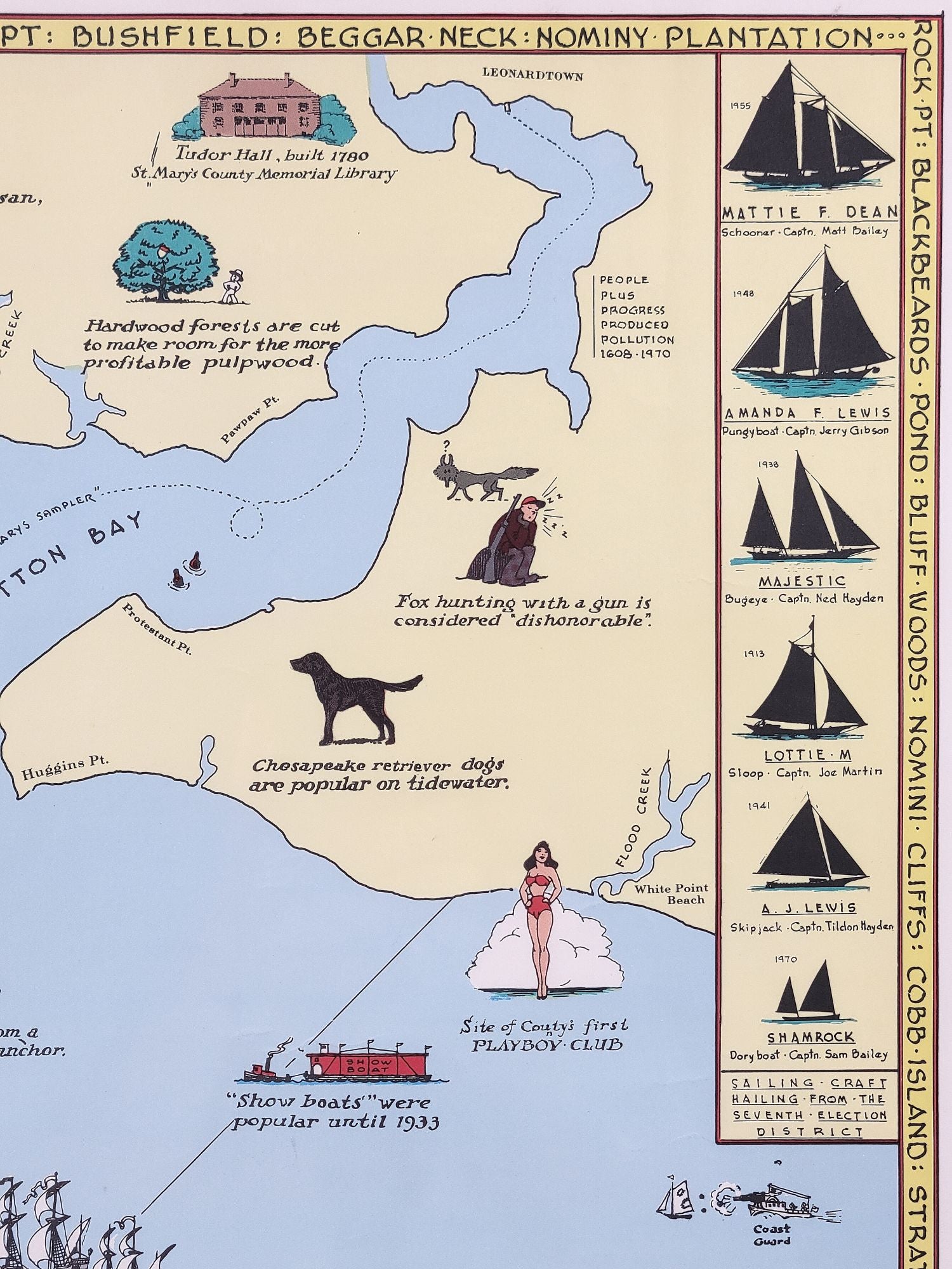
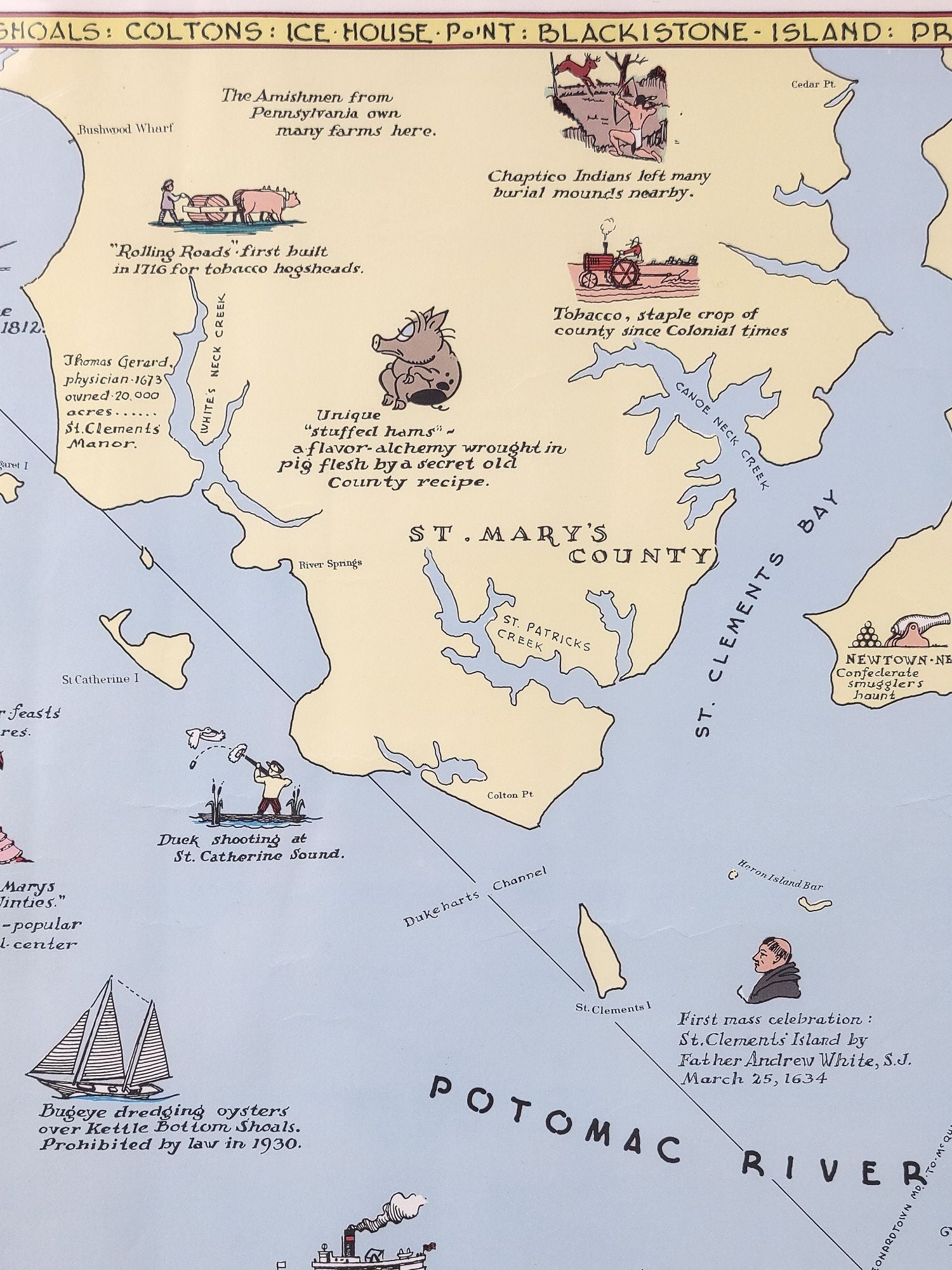
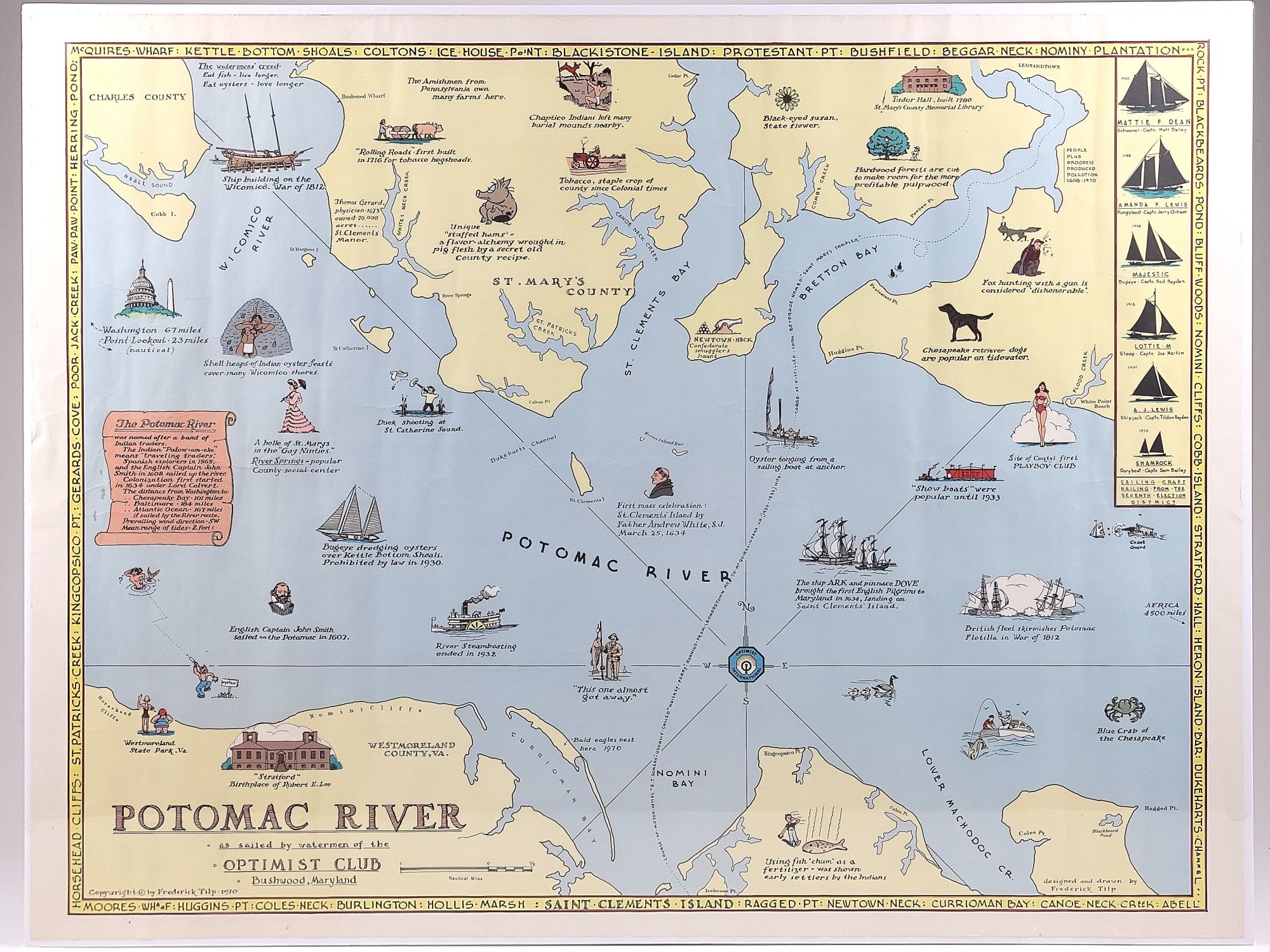
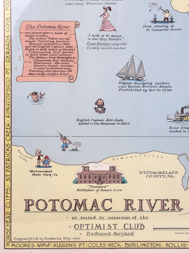
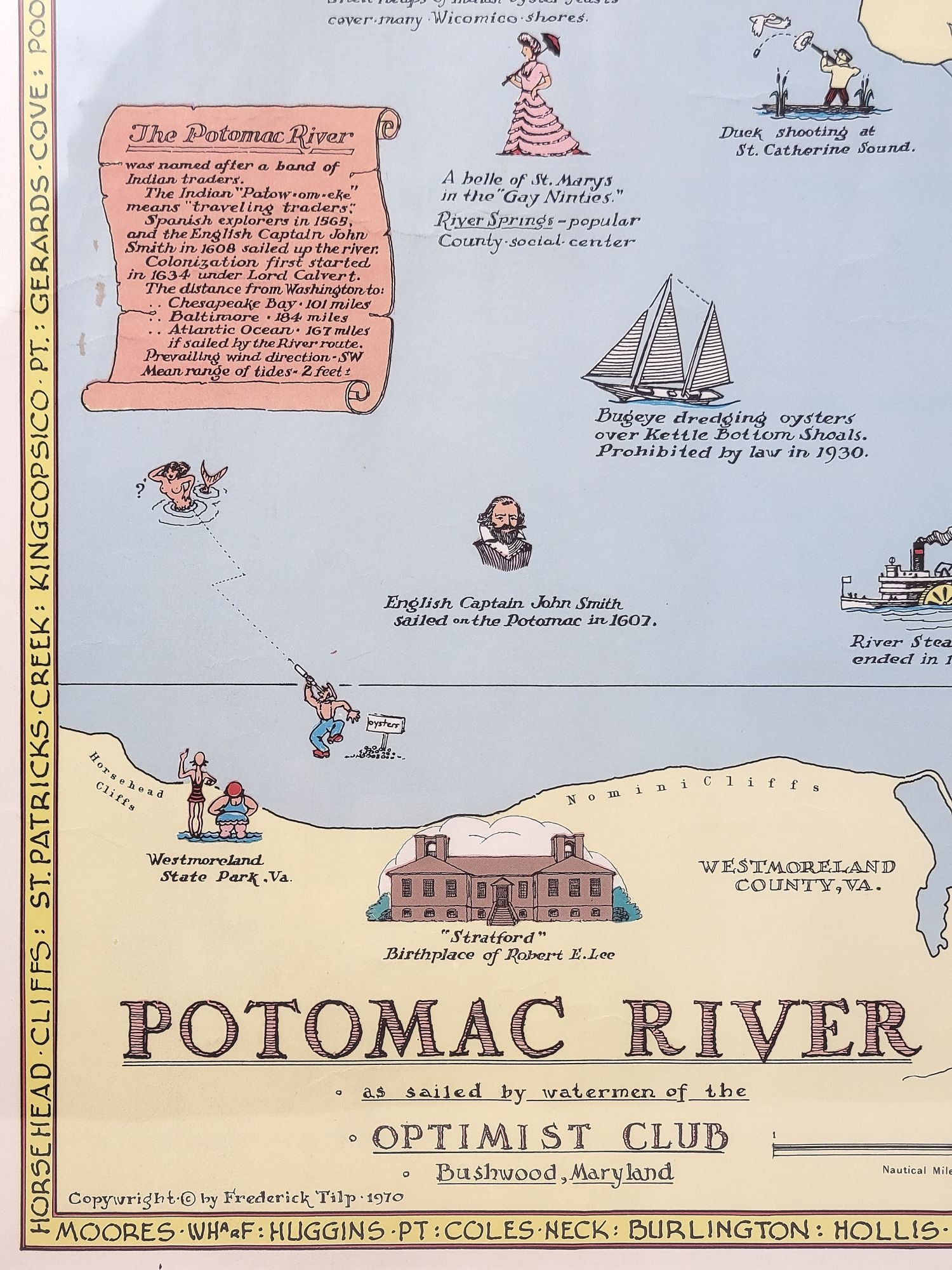
Potomac River as Sailed by Watermen of the Optimist Club, Bushwood, Maryland
[Washington?]: 1970. Color map. Single sheet. 19" x 25"
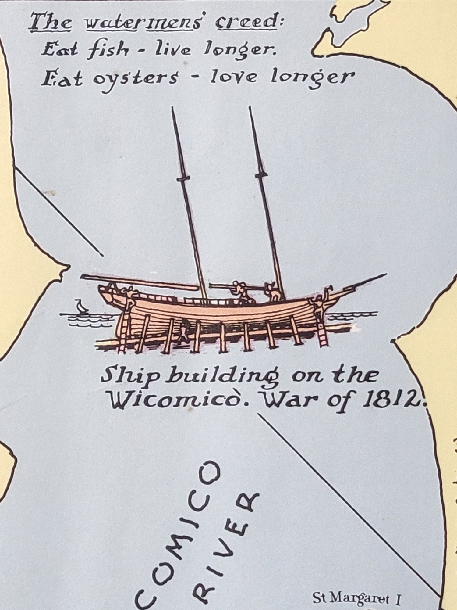
Pictorial map of the lower Potomac River, featuring illustrations marking various points of interest and historic sites. The course of a Prohibition era bootlegger's vessel--the E. T. Somers--is marked between Leonardtown, Maryland and McQuire's Wharf, Virginia. Other decorations include characteristic sailing craft of the region, historical figures, homes, a waterman tonging oysters, etc. Several humorous annotations printed as well.
A very attractive and delightful map.
OCLC locates a single copy--at the Library of Congress.
There are a few edge wrinkles and faint creases, but clean and bright overall.
Item #1312
Sold
See all items by Frederick Tilp