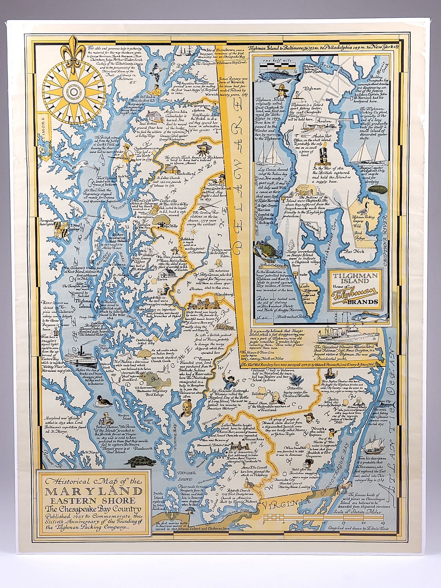
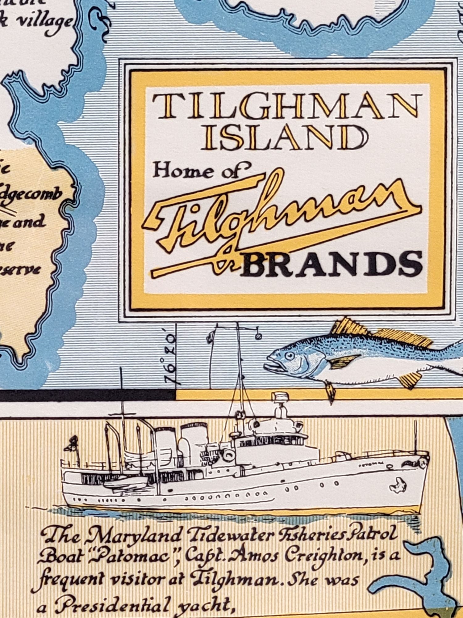
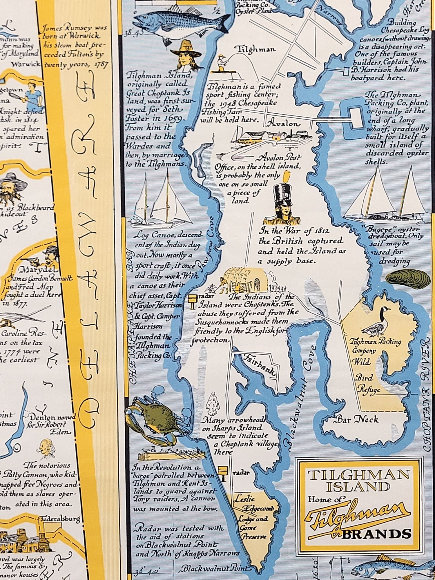
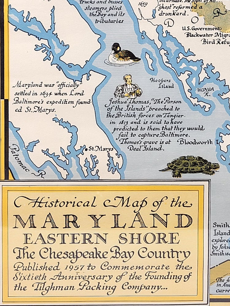
Historical Map of the Maryland Eastern Shore: The Chesapeake Bay Country
[Tilghman Island]: Tilghman Island Packing Company, 1957. Map. 17" x 22"
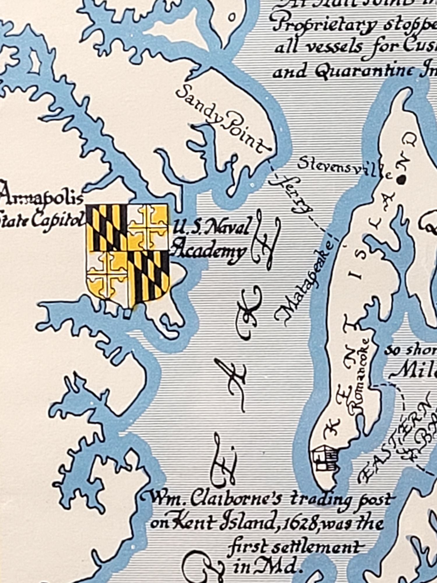
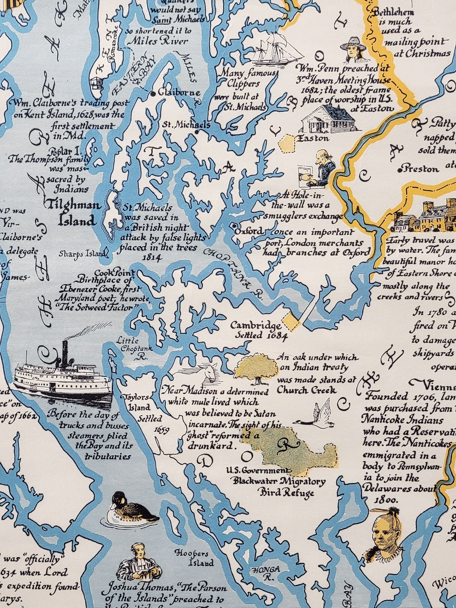
Striking map of Maryland's Eastern Shore by Edwin Tunis. The map was originally published in 1947 to celebrate the 50th anniversary of the founding the Tilghman Packing Company. Reprinted here in 1957 to commemorate the company's 60th anniversary.
This pictorial map is illustrated with many small drawings highlighting historical sights and events related to the history of Maryland's Eastern Shore.
Edwin Tunis, a Newbery Award winning author and illustrator, had a drawing style very similar to that of Eric Sloane.
Uncommon map, with just 2 holdings in OCLC.
Near fine, with just a few edge wrinkles. Overall clean and bright. Unframed.
Item #1311
Sold