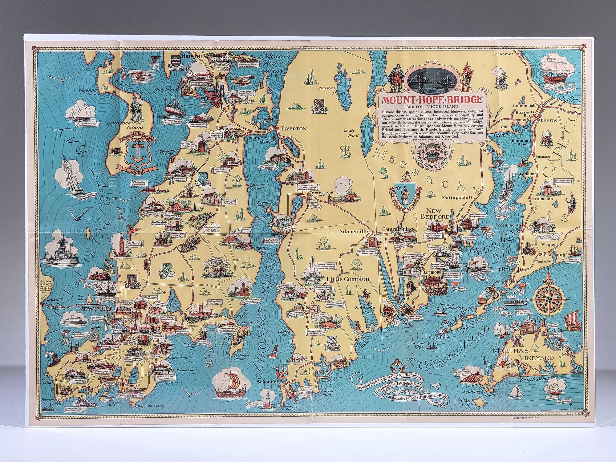
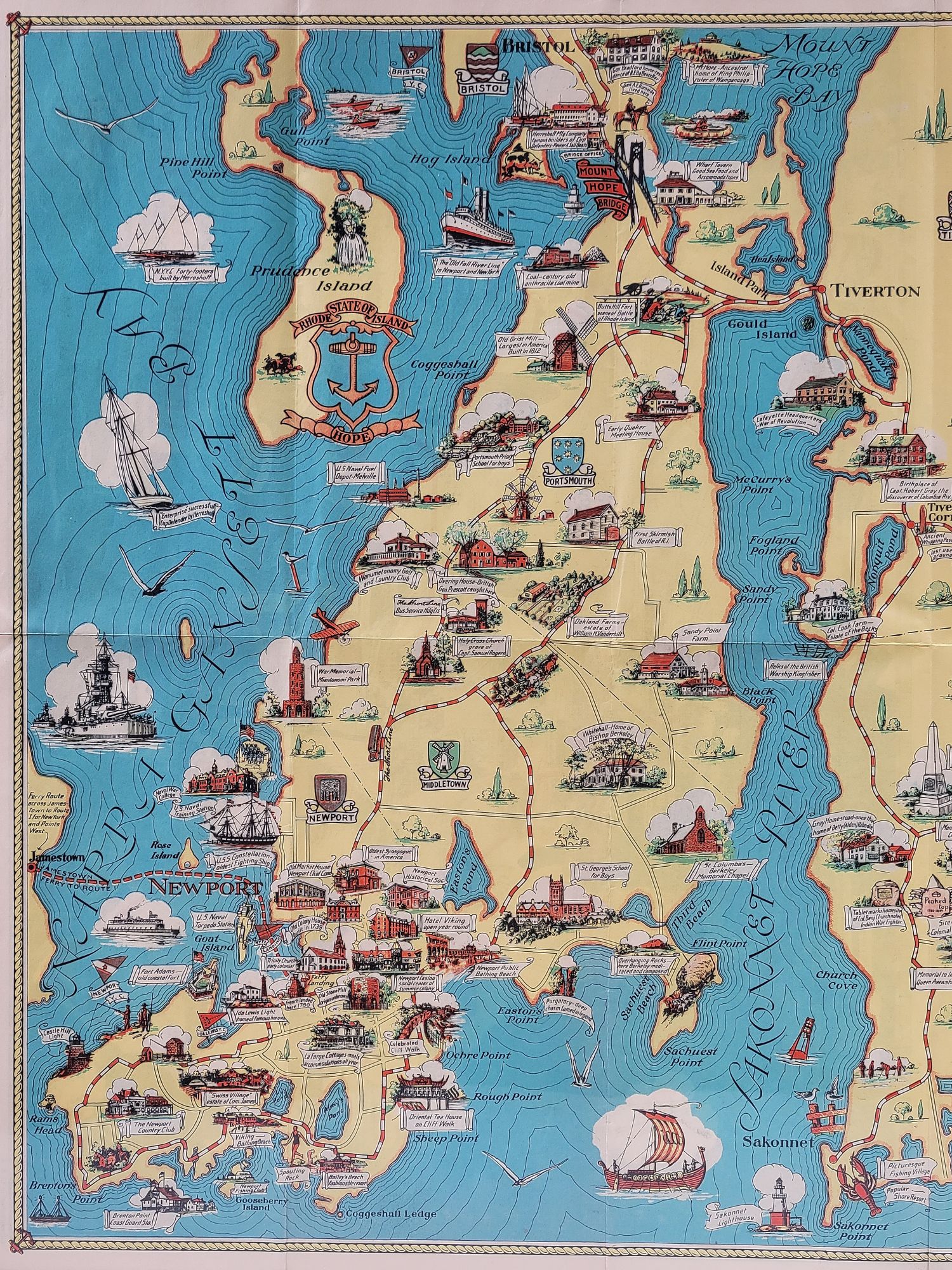
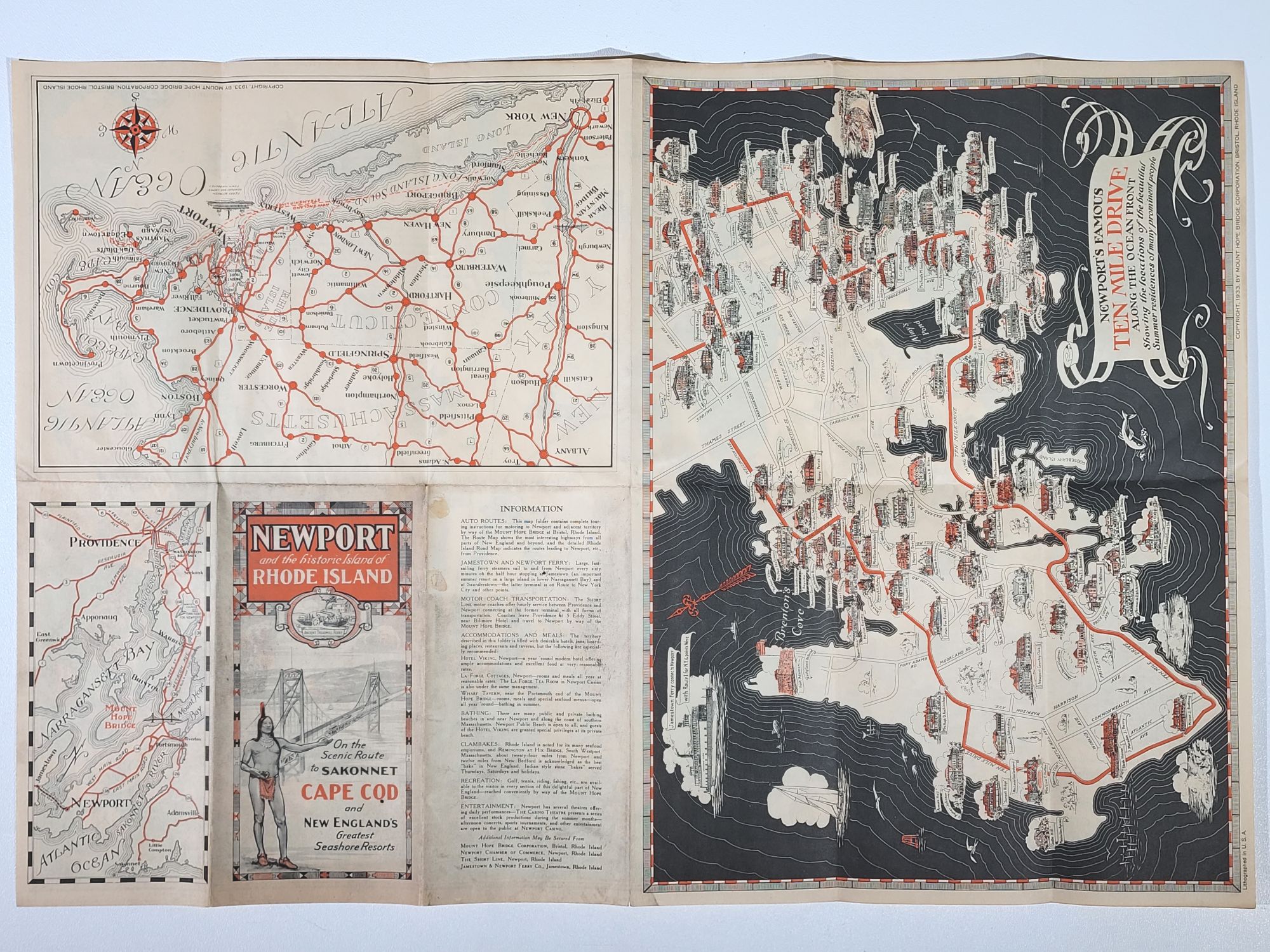
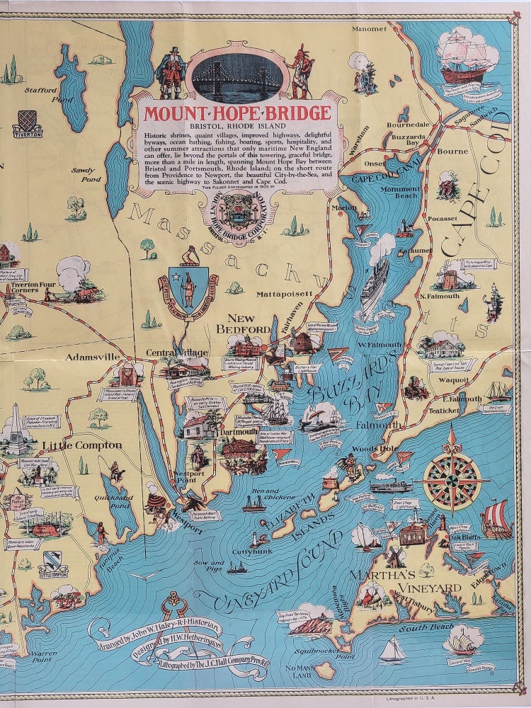
Mount Hope Bridge, Bristol, Rhode Island
Bristol: Mount Hope Bridge Corporation, 1933. Lithographed by J. C. Hall. Folded sheet. 17 3/4" x 26"
This pictorial map was created to publicize the recently opened Mount Hope Bridge connecting Aquidneck Island and Newport with mainland Rhode Island. Researched by John W. Haley and designed by H. W. Hetherington, it emphasizes the maritime history and quaint villages of Rhode Island and eastern Massachusetts.
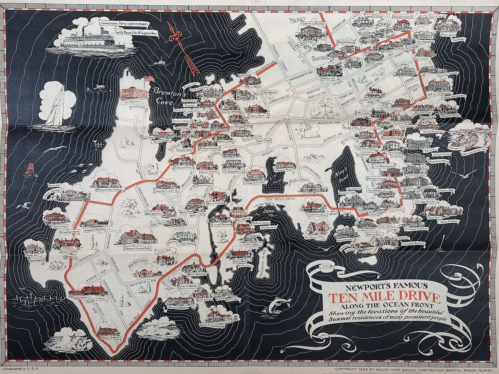
Reverse side contains information about the Mount Hope Bridge, brief tourist information, and three additional maps of the region. The largest of the maps on reverse occupies half the sheet and is a pictorial map of "Newport's Famous Ten Mile Drive Along the Ocean Front Showing the locations of the beautiful Summer residences of many prominent people."
Ref. HORNSBY #82.
Some mild browning. Original fold creases. Near fine overall.
Item #1194
Sold