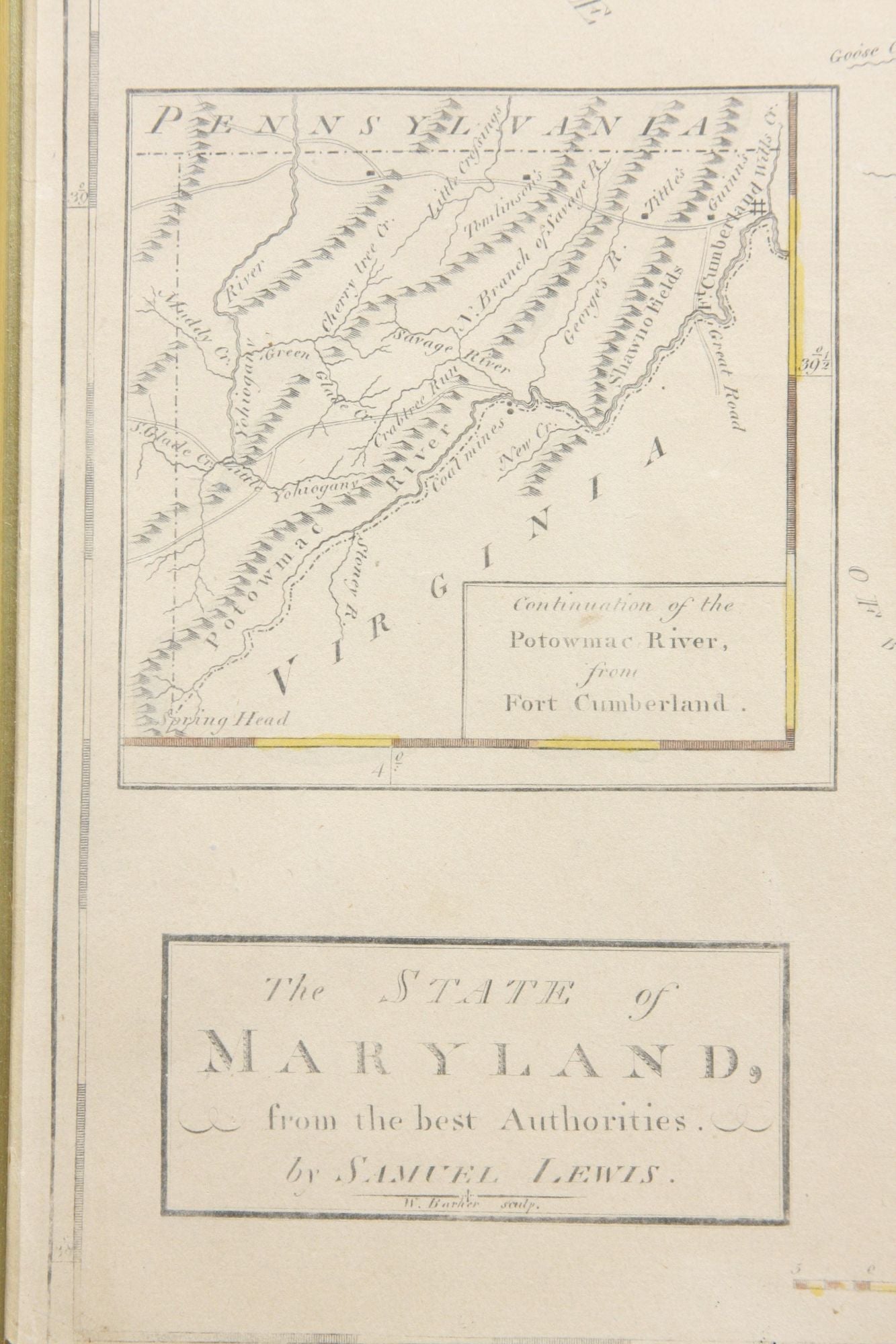
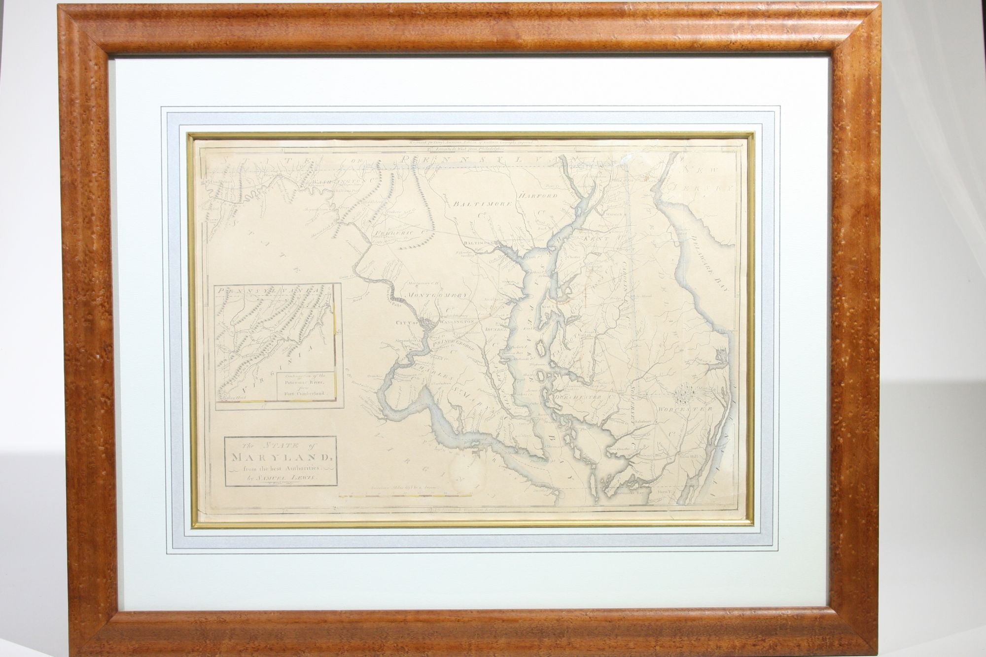
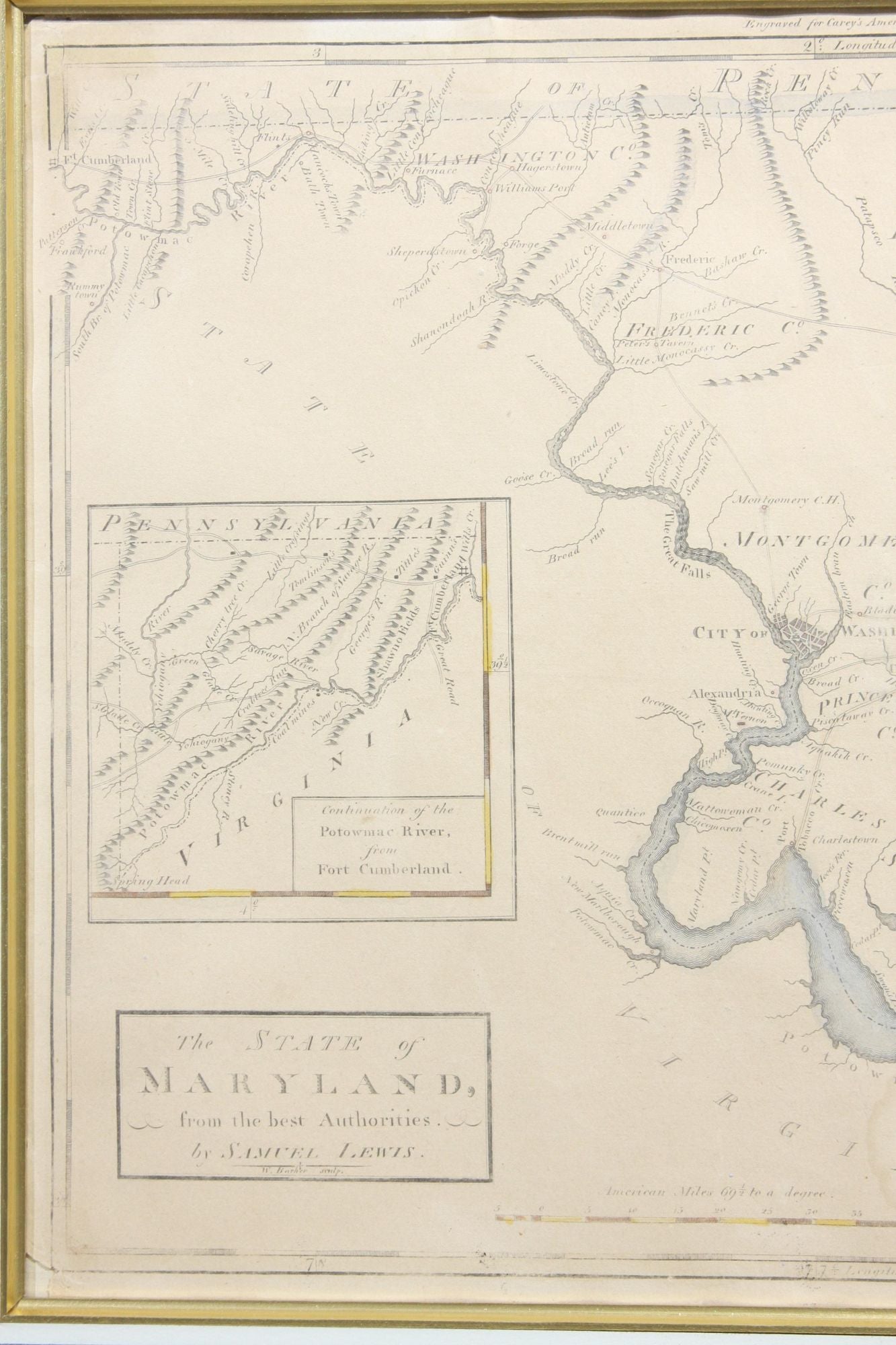
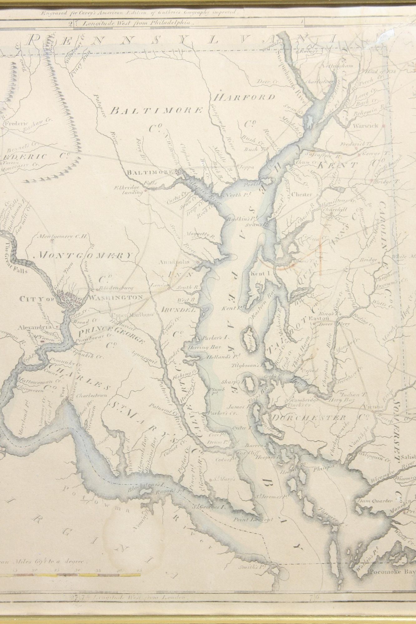
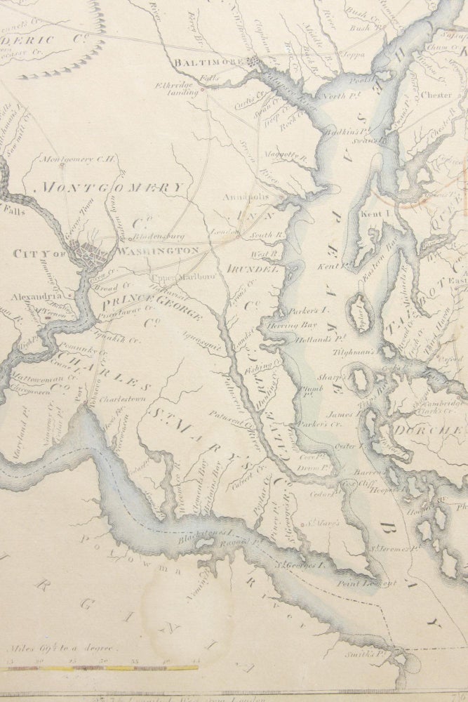
The State of Maryland, from the Best Authorities
Philadelphia: Mathew Carey, 1795. Engraved map. Map.
Uncommon hand-colored map example of the first American-produced atlas map of Maryland. Prominently features the Chesapeake Bay, and Potomac River. Georgetown and the City of Washington are shown, along with an inset "Continuation of the Potowmac River from Fort Cumberland." Engraved by William Barker and printed in Philadelphia for Mathew Carey's American edition of "Guthrie's Geography, Improved." Distance scale at bottom is in American Miles.
Very Good. Map has a few light stains, and a few closed tears. Nicely matted and framed.
Item #11663
Sold
See all items in
Regional
See all items by Samuel Lewis